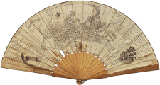
Map of Bath: late 18th century
Map of Bath in the late 18th century, on a fan (nowadays at the Fashion Museum, Assembly Rooms). In addition to the abbey and the baths, the city’s eighteenth-century extension can be noticed: Queen Square, The Circus (which are shown in the perspective views of the round vignettes), The Royal Crescent, the development on the far side of the river - Great Pulteney Street beyond Pulteney Bridge - and to the North Lansdown Crescent.

